


100 Shores and New Spans: Hooper's Island and Cedar Point
- Eric Jackson
- May 13, 2022
- 4 min read

Updated: May 17, 2022
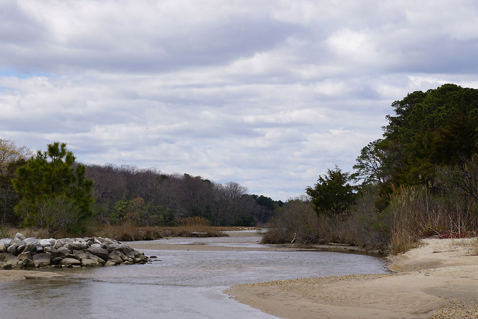
Branding the Chesapeake as a barrier itself is a tough sell, but like I’ve mentioned before, One Hundred Shores is about perspectives. Depending on how you look at it, or where you approach it, the bay tells stories of access to the water. But think about it in another way and it becomes a story of barriers separating our shores. In some cases we’d say a barrier prevents, but in other cases we say it preserves. Two weeks prior to this story, I was standing at Cedar Point in St. Mary's County, staring across the Bay at Hooper's Islands. Now I’m standing on Hooper’s, looking at home less than 10 miles away. And I’m at the end of a four hour road trip. I can’t help but think that in some ways, there’s a big barrier in my way.
In my slightly younger days, we’d complain about how much easier it could be to go party on the OC boardwalk. If they’d just build another bridge for us to Dorchester or Somerset County, we could be out and back faster than a trip to Baltimore. I’m admittedly no longer as hung up on that need (it’d be nice to be a little closer to RaR Brewing…), but I have been paying some attention to the ongoing studies for a possible new span across the Bay. And in a timely bit of news, the Maryland Transportation Authority just announced the completion and formal proposal of a third span… right next to the original spans.
A few years back, maps began circulating of a number of possible third span locations up and down the bay, ranging from Aberdeen- Cecil County in the North all the way down to Lexington Park- Somerset County in the South. Everyone had an opinion (rightly so, I would add) if you saw it on the socials. The maps themselves looked a bit hastily drawn, which had a lot of people wondering how much weight to even put into a discussion of where these “proposed spans” were sited. “Fake News” was also a buzzworthy topic at the time, you may recall.
As it turned out, the map of 14 possible new span locations was official, and for 84 days, the Bay Crossing Study invited public comment on the possible new locations. It’s worth a quick read through if you’re interested. The public opinion seemed to be pretty evenly split. To me it speaks to that familiar feeling we’ve all had when planning a trip to the opposite shore (a frequent occurrence for me lately) or when sitting in the bridge-bound traffic. The reality is that it might suck this morning, or on a Sunday afternoon. But in the long run it’s a reality we come to terms with while feeling slightly apprehensive about the impact of a new span in a nearby community. Quite simply, it’s complex.
So we can think about adding a new span as increasing access and removing a barrier. Doing so will inevitably lead to change. Which is probably why the Bay Crossing Study was conducted in the first place. Depending on your perspective, those changes can be good, and they can be bad. It’ll likely be a mix of both in the Chesapeake. I wasn’t around when the original Bay Bridge span was completed in 1952, or even the second span in 1973 (getting closer though). But what was once an agricultural and watermen community on Kent Island is now a bedroom community of Annapolis which admittedly feels a bit like one endless marina. Removing that barrier changed the culture and even the physical appearance of the community.
Imagine the same story if Hooper’s Island was suddenly a short drive to St. Mary’s County and Pax River Naval Air Station? Granted, the seafood and watermen industry has its own history in St. Mary’s County, but that has for the most part disappeared with the exception of some small, private operations. It’s now a community which largely is built around supporting NAS Pax River and D.C. commuters. Development in St. Mary’s is now a story of affording housing crunches, chain restaurants and 4 lane highways. You can stand in nearby Charlotte Hall and have a choice of FIVE Walmart's within a 30 minute drive.
When you drive to Hooper’s Islands, it comes with the unmistakable feeling that you’re in a different place. It’s not necessarily another world so to speak, but it’s a different story on the tapestry. And you get the feeling that this is the way Hooper’s Island wants Hooper’s Island to be. Can you imagine if these small side streets all of the sudden became transplant communities for Pax River engineers and flight mechanics? With commuter buses crossing a new bridge each morning, how long before Hooper’s Island became one big stretch of marinas, developer’s parcels, and dockside themed restaurants. The picture becomes clearer when you stand on the shore looking across the Bay at a wholly different community, and it becomes clear how rich the tapestry is in the Chesapeake. Like I said, some barriers prevent, some barriers preserve.
In reality, I doubt the southernmost proposed site here at Hooper’s was really given much consideration as a third span location. But here, looking across at the current barrier which is keeping me from home, the interconnectedness of the Chesapeake really comes into full picture. The water itself provides access, and provides barriers. It links us to one another, and it links us to other places even if that link isn't as direct as it could be. The stories which are woven up the bay are stories which weave the same threads further down the bay, and vice versa. A lot to think about on the four hour drive home. Can someone buy me a boat?

Comentários